Comprehensive Plan

Current Comprehensive Plan (Amended through June 30, 2026)
You may download a single, fully-bookmarked version of the current version Comprehensive Plan Text and Map at the following links:
- Comprehensive Plan Text (pdf)
- Comprehensive Plan Map (link)
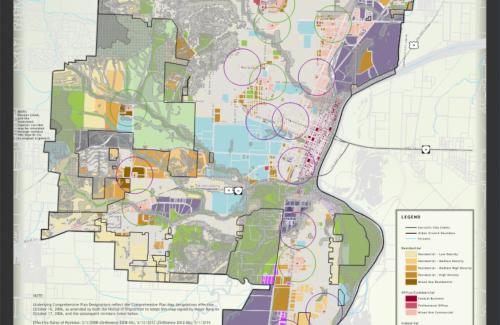
The Comprehensive Plan Map is found below. Physical copies of the Comprehensive Plan Text and Map are also available for review at the Planning Division (City Hall). To purchase physical copies of the Comprehensive Plan Map, please contact the Planning Division. Prices are as follows:
- Printed 18" x 30" color map (small): $11.00
- Printed 36" x 60" color map (large): $22.00
Comprehensive Plan Archives
If you would like to view and download previous versions of the Comprehensive Plan, you may do that here:
What is the Comprehensive Plan?
The Corvallis Comprehensive Plan includes text and a map, and is intended to guide land use planning in Corvallis, based on the City's vision for urban growth management. Comprehensive Plan policies are utilized as part of the review criteria for many types of discretionary land use applications. The current version of the Comprehensive Plan was completed as part of the City’s Periodic Review in 1998, and implemented by the City Council on December 31, 2006. The Comprehensive Plan is a living document that may be amended from time to time by Council.
If you have any questions about the Comprehensive Plan, please contact the Planning Division.