SW Corvallis Area Plan Updates
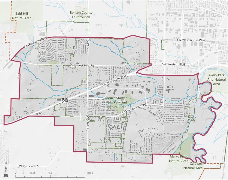
The City is in the beginning stages of developing the SW Corvallis Area Plan. This is roughly the area that is west of the Marys River, and south of SW Reservoir Avenue (see the map below). Please note, this is different than the area plan for South Corvallis (Southtown), which is already underway.
Community Meeting #1 – December 6 from 10am-noon
Join your neighbors at a project kick-off meeting on Saturday, December 6 at Adams School from 10am-noon! You are invited to provide your ideas on how to improve connections for people driving, walking, and biking, and the best locations for future housing, shopping, and employment. Project staff will guide attendees through an interactive exercise to map area opportunities, challenges, and assets. Food and supervised children's activities will be provided.
Mande un correo electrónico o llame a la ciudad de Corvallis para solicitar servicios de interpretación y traducción al español para este evento: Planning@CorvallisOregon.gov, 541-766-6908.
SW Corvallis Area Plan Website
The SW Corvallis Area Plan website is live: www.swcorvallisareaplan.com. This is a great resource to learn about the scope and intent of the SW Corvallis Area Plan, review documents (see the Project Library), sign up for the project mailing list, and keep on top of opportunities to get involved and provide input. En la parte superior hay un botón que traducirá el sitio al español.